A pleasant walk of around 7 miles taking in the formerly industrial Rivelin Valley, now mostly reclaimed by nature and wildlife. An ‘official’ linear walk exists, however, the route described here forms a loop to avoid repetition. Whilst the route is mostly level or gently sloping, to create the loop there are some short climbs along the valley sides
Malin Bridge to Mousehole Forge
Leaving the Park & Ride car park, turn left along the road passing the Malin Bridge Inn on your right. Use the pedestrian crossing to cross over Rivelin Valley road and continue over the bridge, then turning left (signposted Stannington) onto Stannington Road.
Just after taking this road there is a hand gate and steep steel ladders that you may use to descend onto and explore Watersmeet Island if you wish, before continuing along Stannington Road past the pedestrian crossing lights.
Shortly after the crossing follow the bridleway sign heading half-left to pass an electricity substation built on the site of the old Grogram Wheel, behind the Rivelin Fire Station.
Continue following the bridleway left by the river, to reach Mousehole Forge on your right; now privately owned but with some of the old wall visible through the wrought iron gates. Continue along, turning right just before a footbridge and reach an information post for Mousehole Forge.
Mousehole Forge to Roscoe Wheel
The path continues to wind through the trees and over a wooden footbridge; after which turn immediately right, staying next to the river. Follow the path along the river edge and cross the stepping stones, keeping straight ahead on this path until it emerges at a road at a stone bridge.
Cross the side road and continue straight ahead on the path, soon reaching the site of Hollins Bridge Mill. The mill here dates from the early 18th century when its purpose was the grinding of cutlery, fenders and optical glass. Later it was converted to a corn mill before being described as “little used” in the 1930’s. 2 decades later, the area was landscaped and converted into a recreational area, with a water play area, and a playground just upstream at the site of Spooners Wheel, again a site for grinding cutlery as well as files, scythes and other hand tools.
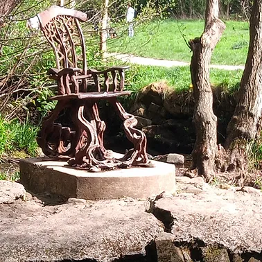
Walk on past the paddling pool on the left and follow the path as it curves to the right past the playground. Continue past the playground and cross a footbridge. Turn right after crossing the footbridge to pass allotments on your left. As the path follows the course of the river swinging left, look to your right for the Rivelin Valley Chair, a steel sculpture installed in 2011. If you wish to access the chair for a closer look you can do so via a short set of stepping stones from the bank at this side of the river.
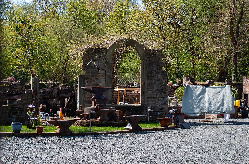
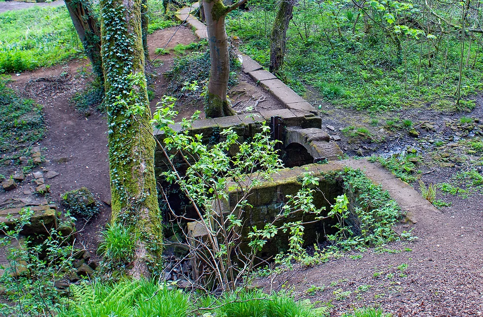
Continue along the path to reach a path crossroads. At this crossroads turn right over the bridge to reach Roscoe Wheel. It is worth partially ascending the stairs behind the site of the Roscoe Wheel site to look down on the remains and imagine the noise of the rushing water and of the industry of the time, in this now peaceful nature reserve
View photos of Roscoe Wheel
Return to the footbridge and head right before crossing, to follow the path between the river on your left and the Roscoe Wheel site on your right.
Roscoe Wheel to Upper Cut Wheel
Upon reaching a set of stepping stones, ignore these and instead head right on a path through the trees. This path climbs above the river and then passes through an old fence. Follow this clear path which is not marked on maps, as it winds sharply right and steeply uphill briefly, before bending back to the left following the line of the river which is out of sight but within earshot. Houses are visible to your right as the path levels out then begins to drop back down towards the river then levels again, winding through the trees to meet Rivelin Valley Road.
As you emerge at the main road, head left then carefully cross over the road in the middle of the bridge, and head down the steps which are slightly to your left, marked with a Public Footpath sign. These steps descend to Upper Cut Wheel.
Upper Cut Wheel to Frank Wheel
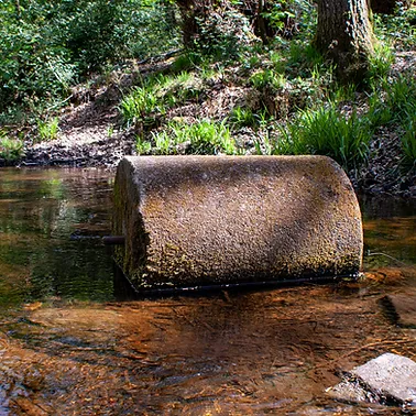
Follow this pleasant footpath between a channel to your left and the river to your right, passing an old grinding wheel sat in the channel, eventually reaching a path junction just after a small footbridge with the remains of a gate roller assembly on the bridge. At this junction head half-right over a footbridge with metal railings to reach Hind Wheel.
The first recorded wheel in the valley, the history of Hind Wheel dates from 1581, the year in which Sir Francis Drake was knighted following his circumnavigation of the world in the previous year aboard the Golden Hind, although it is not known whether the naming of the site is coincidental. Hind wheel was mostly used in the manufacture of cutlery and inserts for ladies’ corsets.
After falling into disuse in the 1930s, the ruins of the buildings were demolished in the 1950s and landscaped, with further clearing of the dam in the late 1960’s, with the site now popular for picnics as well as a haven for wildlife.
At Hind Wheel follow the footpath left to skirt around the lake, then keep following the path with the river to your left, to reach a post marking the site of Plonk Wheel and then shortly after this, the site of Swallow Wheel.
After Swallow Wheel go straight ahead at a path junction, cross two small footbridges with metal railings and then at a footpath crossroads, stay straight ahead and up a flight of stone steps to a pond. Continue beside the pond to reach Wolf Wheel.
At the next footpath junction, ignore the metal railing footbridge to your left, instead go straight ahead to reach the post marking Frank Wheel.

Frank Wheel to Rails Road
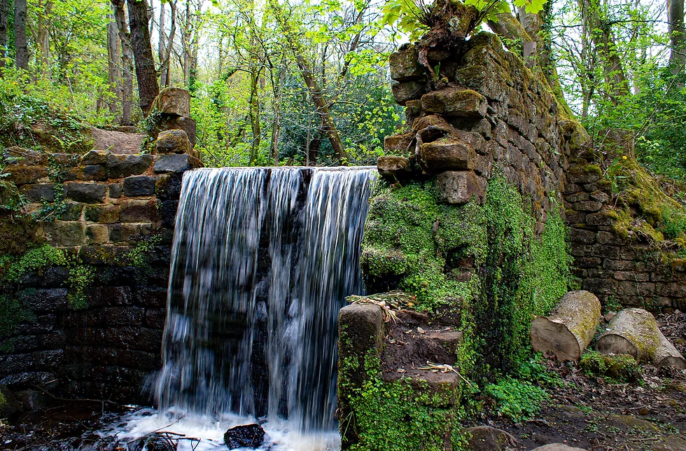
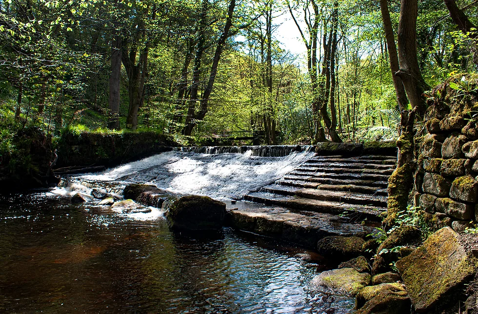
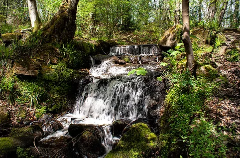
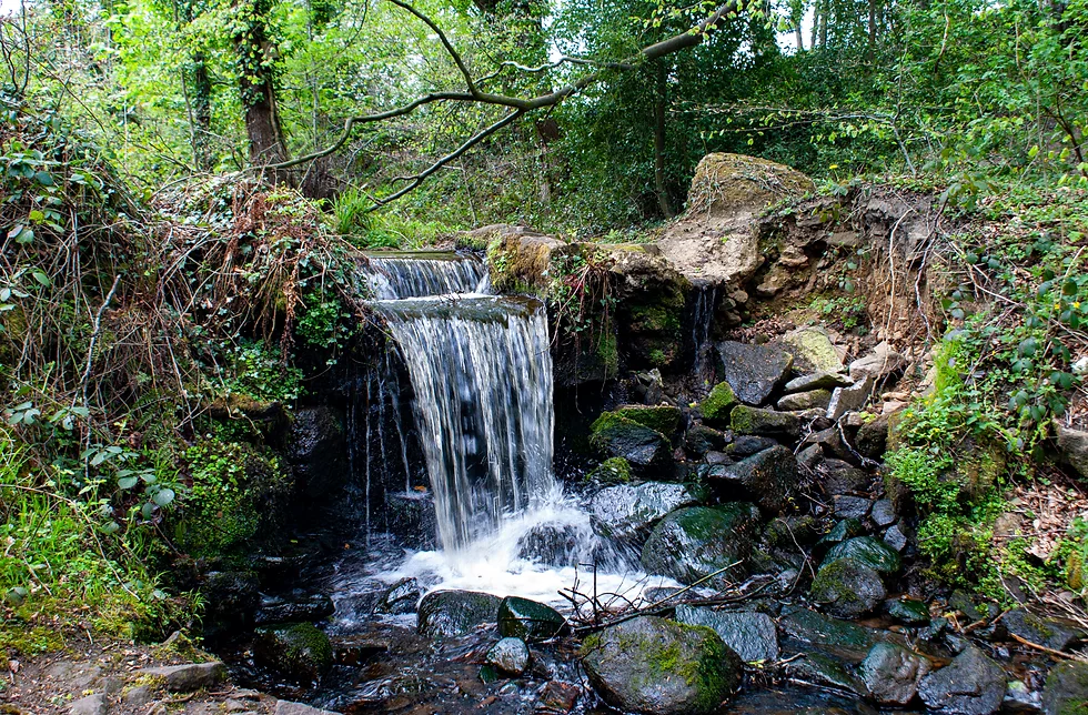
Continue along the path keeping the river to your left, pass another wier and then through a clearing. At the end of the clearing as you head back into the woods, stay left on the narrower path which hugs the river bank. Look left to see a tall waterfall. After passing the waterfall head up the steps. At the top of the steps head immediately right, walking along the top of a dam wall, to reach the information post for Third Coppice Wheel
After exploring this site go back the way you came over the top of the dam wall and head right to continue as you were headed. Cross one set of stepping stones, walk carefully over a low dam wall, then cross a second set of stepping stones. With the river to your left, continue along the path until you reach Second Coppice Wheel on your right
Continue along the path and very soon arrive at Upper Coppice Wheel.
After Upper Coppice Wheel, arrive at a stone bridge crossing right to left over the river. Keep straight ahead to emerge onto Rails Road. The car park here is the site of Rivelin Corn Mill which was used from around 1600.
Rails Road to Samehill Farm
Head back to the bridge, cross it and turn left heading back the way you originally came on the opposite bank of the river.
arrive at a stone bridge crossing right to left over the river. Turn left across this bridge then left again heading back the way you came on the opposite bank of the river.
The footpath begins to climb and head away from the river. At a footpath junction with stone walls, bear slightly left following the direction of the river and keep following this course with a meadow on your right before dropping steeply down to carefully ford a stream. Take care at this point crossing the stream as some of the stones are exceptionally slippery, then climb steeply up the opposite bank to turn left along a clear wide path.
[To avoid fording the stream you can, at the previous junction, instead head right and climb to the main Manchester Road then take a left back down the next footpath which leads to this point]
Follow this clear path to reach a gate. Bear left following the footpath as it continues along higher ground and then drops back down to the level of the river at a footbridge. Cross this footbridge and turn right along the river path near Wolf Wheel which you passed on the outward leg, past the pond and down the steps. After descending the steps head right over a footbridge and begin to climb quite steeply uphill with a stone wall on your right. Cross a stile and follow the footpath half-right to the wall then up alongside the wall to the top-right corner.
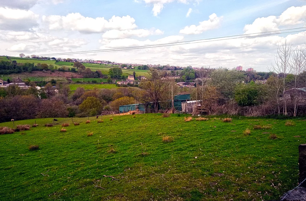
At the corner of the walls turn left along the top of the field, cross over a stile and pass a gate leading onto a wider track with contrasting views of the Rivelin Valley countryside and the urban sprawl of Stannington to the left above the valley. Continue along this track past Samehill Farm. The track eventually becomes a tarmacked road. Continue to farm outbuildings on your right and shortly afterwards, opposite a clear Public Footpath sign on your right, take the footpath on the left through a gap in the wooden fence, heading downhill. Bear left as the footpath descends and then turn right at the bottom.
Samehill Farm back to New Dam
Head along this path which you will recognise from the outbound section of the walk, until you climb the steps back up to Rivelin Valley Road at the S-bend. Cross over carefully and head right beside the road, then left through the barrier along the path signed ‘Rivelin Valley’ and slightly downhill to a pond at the site of Nether Cut Wheel. After the pond take the left of the two paths that follow the course of the river. Cross a footbridge then reach a path junction at Little London Wheel with an information post just to your right.
At this path junction head left to continue along the river, shortly reaching Holme Head Wheel which was used for grinding cutlery and razor blades from around 1742 until the late 1920’s / early 1930’s
Follow the path along the side of the river and reaching the allotments on your right. On reaching the bridge on your left, turn left across the bridge heading towards Roscoe Wheel once again, but this time turn right immediately after crossing the bridge and follow the path beside the river, passing once again the Rivelin Valley Chair this time on your right.
Follow this path as the river curves right to reach the site of New Dam. The path then heads up steps and reaches the end of a minor road. At the road head right downhill to the playground. Keep along this path as it curves left past the playground and the lido, retracing your steps from earlier until reaching the side road at the stone bridge.
New Dam Returning to Malin Bridge
Emerge onto the side road, cross over and go right, crossing the bridge, then left on the footpath alongside Rivelin Valley Road. At the gap in the wall head left on the footpath marked ‘Easy Going Trail’ to join the river once again. Pass a small lake and approach a small car park at the site of Walkley Tilt.
Keep straight ahead across the car park following the Public Footpath sign and reach a bridge approaching a pelican crossing. Go over the bridge and use the crossing to cross Rivelin Valley Road, then head left, past the fire station.
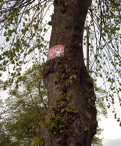
At this point (at the time of writing the walk guide) you may see evidence left of protest signs affixed high up on some of the lime trees that line this road; remnants of recent and eventually successful protests against a policy of widespread tree felling by Sheffield City Council, documented by two prominent activists in the book “Persons Unknown: The Battle for Sheffield’s Street Trees“
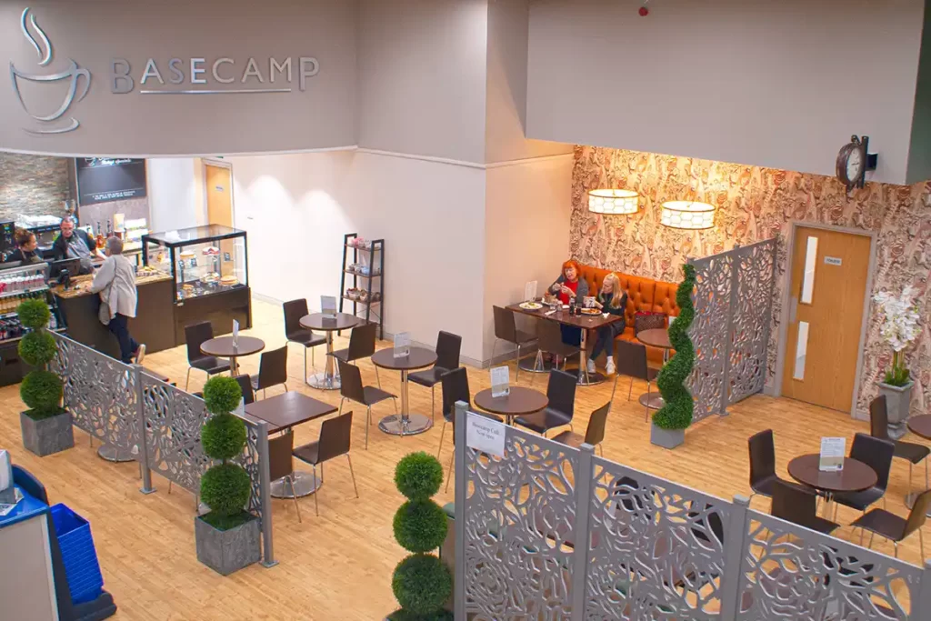
Head along Rivelin Valley Road crossing Watersmeet Road to the end, then head right back to the Park & Ride and to the Base Camp Cafe for some well earned refreshment!